Geodetic Science
Geodesy is the science of measuring the earth's size, shape, orientation in space, and gravity—elements that are constantly changing. This field of study dates back to ancient Greece, when Eratosthenes measured the circumference of the earth using shadows. Today, geodesy is essential for modern navigation—GPS relies upon accurate geodetic measurements—as well as climate research and many other applications. Every day, without knowing it, people use technology that depends upon precise geodetic measurements.
Haystack scientists and engineers work in space geodesy and polar geodesy.
Space Geodesy and VLBI
The focus of space geodesy is obtaining high-precision measurements using geodetic techniques such as very long baseline interferometry (VLBI) and the global navigational satellite system (GNSS, a general term for systems like GPS). Specifically, high-precision geodesy means measuring the position of a point on the surface of the earth with millimeter accuracy. It also means measuring variations in the length of the day to a few millionths of a second, or the orientation of the rotation axis of the earth in space to a few billionths of a degree.
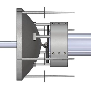
In precision geodesy, VLBI is used to make measurements from pairs of radio telescopes of an extragalactic object such as a quasar that—from Earth—appears at a fixed point in space. The measurements are time-tagged via hydrogen maser clocks. By measuring the exact time the signal coming from the same object reaches each radio telescope, VLBI allows scientists to determine the precise position of each station. These accurate location measurements enable geodesists to calculate the rotation of the Earth. Knowing how fast the Earth is rotating is essential to maintaining an accurate measurement of Universal Time (UT1). Minute variations in the rotation of the Earth are caused by planetary forces (primarily the Sun and the Moon) and forces from geophysical fluids (oceans and atmosphere).
Data from VLBI observations contribute to the calculation of the International Terrestrial Reference Frame (ITRF) and the International Celestial Reference Frame (ICRF), which provide coordinates of fiducial points on the Earth’s surface and in space. These systems are crucial for surveying, satellite navigation, and communications as a set of time-dependent reference points that are continually updated.
Geodetic VLBI also allows scientists to measure the movement of the Earth’s tectonic plates extremely accurately. For example, VLBI measurements of the distance between the radio antennas at Westford, Massachusetts, and Wettzell, Germany, show that North America and Europe are presently separating at a steady rate of about 17 millimeters per year. Scientists also use geodetic VLBI and GNSS to measure changes in the position of the San Andreas fault in California, as the Pacific plate slips past the North American plate at the rate of about 50 millimeters per year.
VGOS
VGOS is a key observational element of the Global Geodetic Observing System (GGOS), an organizational component of the International Association of Geodesy (IAG) that contributes to a comprehensive monitoring of the Earth system. A major goal of GGOS is to ensure that observations from the four fundamental space geodetic techniques—VGOS (VLBI), GPS, SLR, and DORIS—are rigorously combined to realize an accurate and stable TRF. The TRF is crucial for advancing our understanding of critical components of the Earth system, such as the global hydrological cycle, which includes the cryosphere, and the dynamics of the oceans and the atmosphere.
The TRF is also important for natural hazard warning and prevention, disaster mitigation, sustainable development, and society at large, as underscored in a resolution recently adopted by the United Nations (UN) General Assembly and promoted by the UN Global Geospatial Information Management Initiative (UN-GGIM) and the Subcommittee on Geodesy.
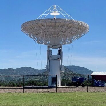
Haystack is a prominent contributor to analysis and technical development at the International VLBI Service for Geodesy and Astrometry (IVS), which provides geodetic and astrometric data products that contribute to calculations of the TRF, the international celestial reference frame (ICRF), and Earth orientation parameters (EOP). The Westford antenna is a primary geodetic site within the IVS and a fundamental station participant in the VGOS network rollout.
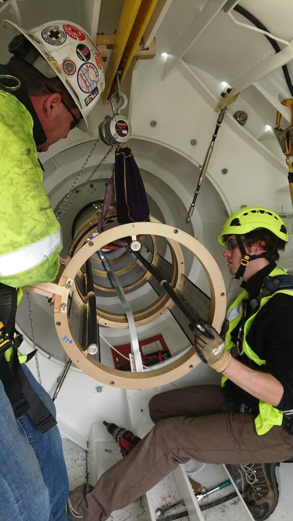
Under the aegis of its Space Geodesy Project (SGP), NASA is leading the development of a global network of GGOS stations. The goal is to deploy about 10 NASA-funded stations that are globally distributed in the coming years. The NASA network will be expanded with additional stations funded and built by international partners, with the goal of eventually forming a global array of about 40 GGOS stations that spans the Earth’s surface with a homogeneous distribution.
Haystack frequently releases forward-looking software and technologies with the aim of advancing VLBI systems and bringing new levels of flexibility and measurement accuracy to the geodetic VLBI community. This effort helps shape the GGOS vision even for systems that will succeed the VGOS network, which is currently in a rollout phase. The effort leverages and overlaps with an installed base of networked broadband systems around the world. Among the topics being explored are lower-cost antennas, improved cryogenic systems, novel observing strategies, better methods for estimating water vapor in the troposphere, correlation systems that are easier to port and maintain in the face of evolving computing platform architectures, and more sophisticated data reduction and analysis approaches to make better use of the inherent information content of the data.
Haystack continues to make major contributions toward the validation of the VGOS concept, as well as toward improving and maintaining the global network of NASA VLBI stations, both broadband VGOS and the dual-frequency legacy systems.
Polar Geodesy
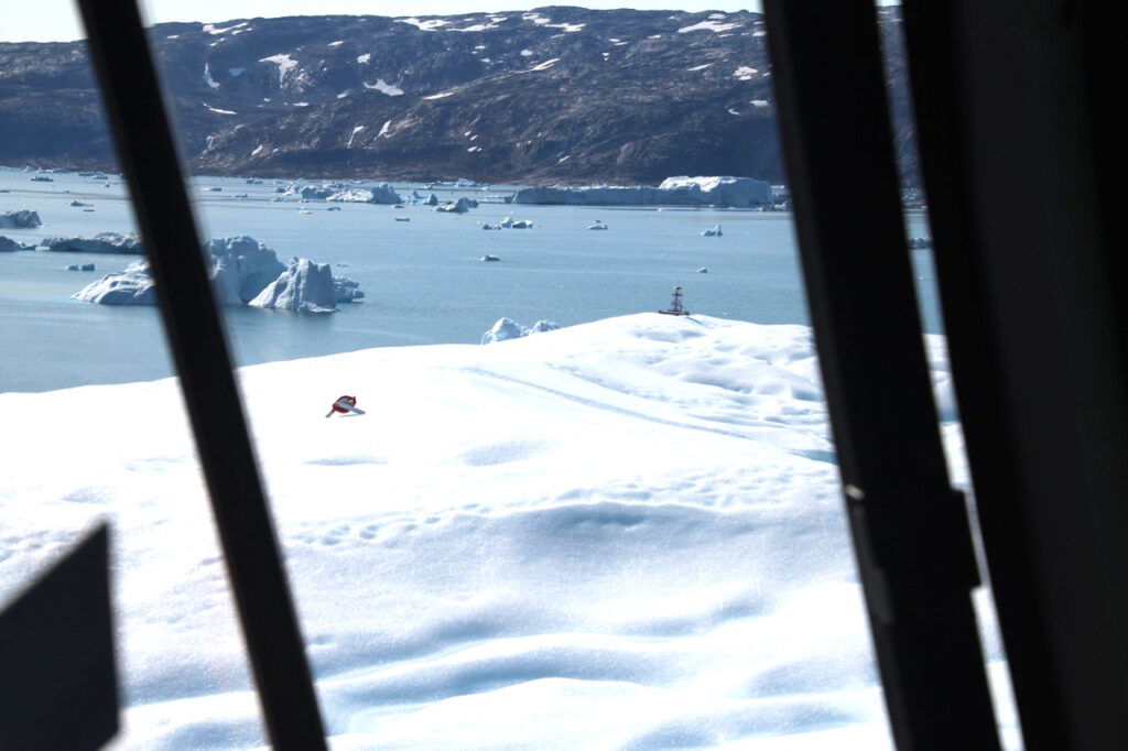
Haystack contributes extensive research on applications in polar geodesy, which is relevant to the high-profile topics of global climate and sea level change. Collaborative polar efforts have been solidified with several institutions and various agencies. These efforts are focused on the cryosphere and based on precision measurement of various forms of ice—sea ice, glacier, iceberg, ice shelves—flow, drift, and deform via deployable GPS-based systems specifically developed for iceberg studies by Haystack.
Haystack projects in polar geodesy include an Antarctic seismo-geodetic ice penetrator (SGIP) and Arctic ice measurement (SIDEx).
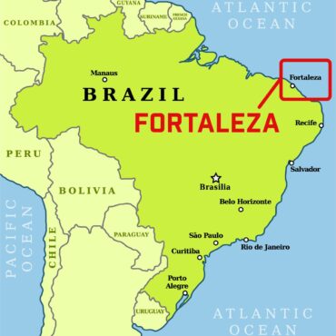
Fortaleza: The Next Generation of VLBI Telescopes
Haystack is designing and installing the signal chain for a new NASA radio telescope in Fortaleza, Brazil.
SGIP: Antarctic Seismo-Geodetic Ice Penetrator
Monitoring the response of ice shelves in Antarctica to ocean forces.
Co-located techniques and atmospheric ties
Developing a method to incorporate constraints from atmospheric structure to improve the accuracy of relative site position estimates and ITRF combinations.