Geospace Projects
Haystack’s Atmospheric and Geospace Sciences group has a significant experimental and remote sensing program with a strong and productive history. We are always pursuing many projects, highlighted here, that span the disciplines of remote sensing as applied to near-Earth space across a wide span of electromagnetic frequencies.All Projects
ElectroMagnetic Vector Sensor Ionospheric Sounder (EMVSIS)
EMVSIS (pronounced "emphasis") is a brand-new radar network for studying the effects of the 2024 solar eclipse on the Earth's atmosphere.
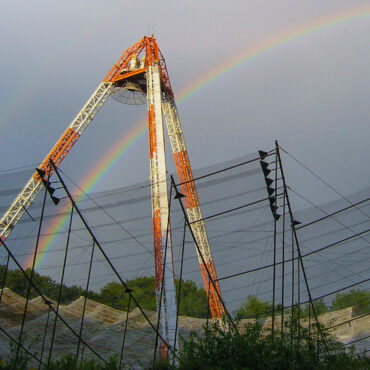
Millstone Hill Incoherent Scatter Radar
Incoherent scatter radar (ISR) has proved to be the most powerful and flexible ground-based instrument for probing the dynamics of thermal plasma in Earth’s ionosphere.
Madrigal Geospace Database
An upper-atmospheric science database at Haystack used by groups throughout the world. Madrigal manages archival and real-time data from a wide range of upper-atmospheric science instruments.
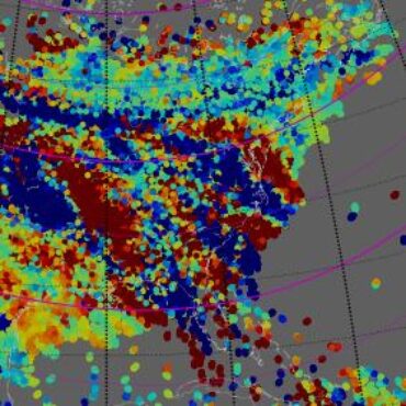
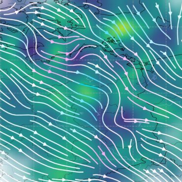
Using GNSS to Measure Ionospheric TEC
GNSS systems for precision location yield as a by-product measurements of the total electron content (TEC) of the ionosphere. MIT makes this popular data available to the geospace community.
AERO-VISTA CubeSat mission
A NASA twin CubeSat mission for auroral radio science and space interferometry technology.
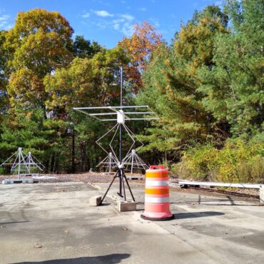
RAPID: Radio Array of Portable Interferometric Detectors
Advanced radio array designed for geospace and astronomy. The system implements a sparse and spatially diverse radio array technology to enable a wide range of scientific experiments.
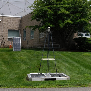
Zephyr Meteor Radar Network
A novel multiple-input/multiple-output (MIMO) radar network designed to estimate the 3D wind field in the upper atmosphere by way of meteor trail scattering.
MACAWS: Monitors for Alaskan and Canadian Auroral Weather in Space
A sensor web network providing both real-time and historical GNSS TEC and scintillation data products.
Software-Defined Radio
A cornerstone technology for the rapid development of new geospace sensors and techniques.