MACAWS: Monitors for Alaskan and Canadian Auroral Weather in Space
The MRI Collaborative’s Development of Monitors for Alaskan and Canadian Auroral Weather in Space (MACAWS) is a sensor web network that provides both real-time and historical Global Navigation Satellite System (GNSS) TEC and scintillation data products. This data is needed for geospace science and space weather monitoring in the currently unsampled or under-sampled auroral regions in North America (Alaska) and northwestern Canada. These regions are significant as they are the locations of origin for the majority of space weather events that affect the United States. Alaska is rapidly expanding in both commercial and DOD operations, and GNSS infrastructure is needed to aid in monitoring space weather events. We are collaborating with the University of Calgary to build the sensor network and with the University of Alaska.
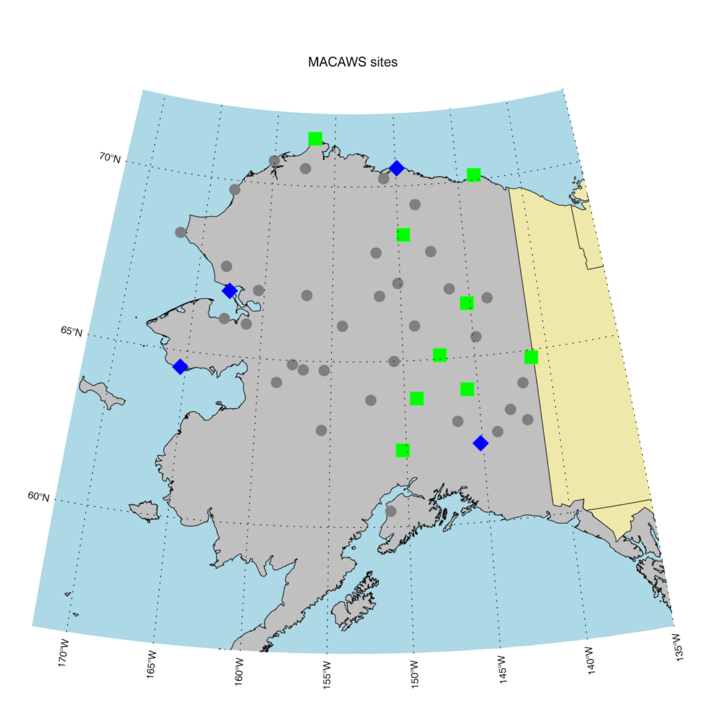
The plan is to install 35 GNSS TEC and scintillation receivers in Canada and northern Alaska to track both the Global Positioning System (GPS) and Global Navigation Satellite System (GLONASS) constellations and to compute TEC and scintillation statistics for the acquired datasets. All data will be hosted in Haystack’s Madrigal database. Thus far, 34 of these receivers have been sent to Alaska and Calgary, Canada, several of which have been deployed, and the remaining are awaiting deployment, which has been delayed due to COVID-19. One receiver has also been deployed at Arecibo Observatory.
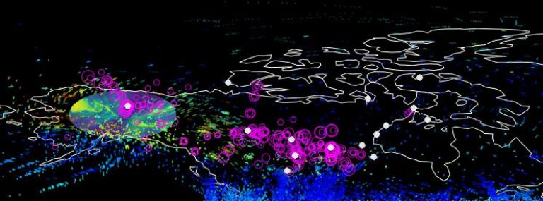
The MACAWS project will provide significant new space weather data products and capabilities in a region (northwestern Canada and northern Alaska) that currently has scarce space weather instrumentation. This new instrumentation provides data that can be used to increase our understanding of space weather and to aid in its prediction, since these are the regions where significant space weather events typically begin in the North American sector. The MACAWS project merges GPS and GLONASS TEC observations into a unified North American TEC map. MACAWS data will aid in development and deployment of triggering algorithms to collect the high-rate GNSS scintillation data during highly dynamic time periods and will aid in the distribution of real-time TEC data to users.
The development of a sensor web is required to accomplish the goals of the MACAWS project. A sensor web is a dynamic, adaptable, and autonomous network of sensors. Using artificial intelligence (AI), a sensor web reacts in real time to information from its instruments, invoking information sharing, and autonomous decision-making, feedback, and control. This capability provides a combination of greatly enhanced information content in the overall data and/or vastly improved resource efficiency. Research into sensor webs is rapidly expanding; they are emerging as the primary viable path forward for large-scale (big data) Earth observing systems. As part of a cost-sharing agreement with the University of Calgary, significant effort will be expended toward the development of these capabilities.
Our collaborators are the University of Calgary and the University of Alaska.