Using GNSS to measure ionospheric TEC
Total electron content (TEC) is measured from the time delay between two frequencies. All GNSS systems (GPS, GLONASS, and others) currently operate on two or more frequencies. Typically only a single frequency is used (i.e., the GPS receivers in your car). Geodetic science, land surveying, high-precision farming are some of the uses that require high-precision measurements. Data from these dual-frequency receivers, located over the globe, are used to compute the daily GNSS TEC maps.
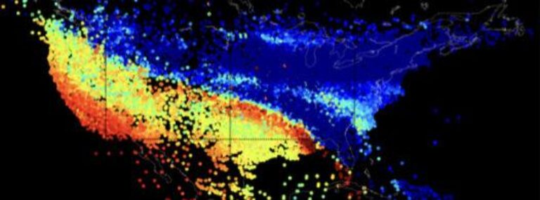
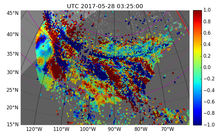
Total Electron Content (TEC) data products produced by the MIT Automated Processing of GPS (MAPGPS) software suite are enormously popular in the CEDAR community. These now include binned vertical TEC maps and, more recently, line-of-sight TEC data highly suitable for computing sensitive differential TEC products.
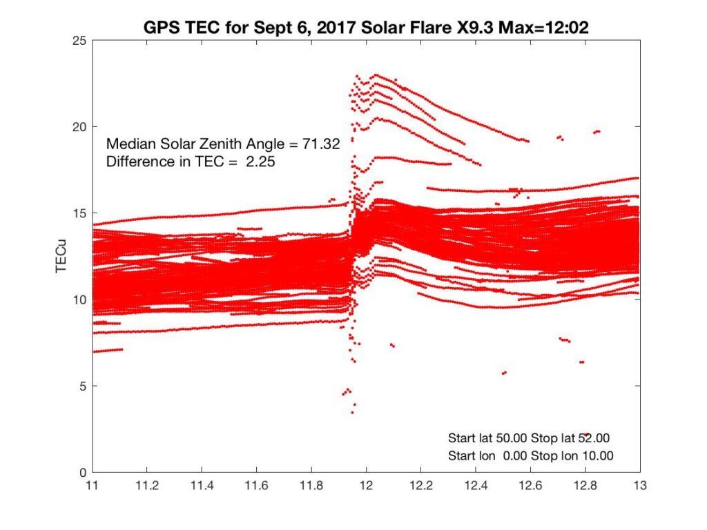
These data sets are used in many high-impact scientific studies. For example, TEC data from Madrigal was used in 48 peer-reviewed publications from October 1, 2016 to November 30, 2018. Topics included in these publications covered the Great American Solar Eclipse, the large 2017 solar flares, TEC disturbances due to an anomalous heat wave over the United States, and multiple geomagnetic storm studies.
On a daily basis, we gather and process TEC data from a distributed network of more than 6,000 GNSS receivers worldwide—and this number is rapidly increasing. TEC analysis products are calculated after waiting for data to become fully available using a batch processing approach. A first pass is done and complete about one week behind real-time, and a final run is done about two months behind that. Both line-of-sight and vertical TEC observations with bias calibration are provided via the CEDAR Madrigal system.
Our paper “Statistical framework for estimating GNSS bias” contains information on how GNSS satellite and receiver biases are removed for proper TEC calibration.