Team sent to Antarctica to measure ice shelf stability
After years of preparation, the MIT Haystack Observatory polar geodesy team has deployed to McMurdo Station in Antarctica. As described in the Boston Globe, Haystack scientists and engineers have designed, prototyped, tested, and built a research device called a seismo-geodetic ice penetrator (SGIP), which is about to be deployed onto the Ross Ice Shelf. Geodesy is the science of measuring the earth, including its geometry, gravity, and orientation in space, and polar geodesy measures the earth’s cryosphere, or frozen water.
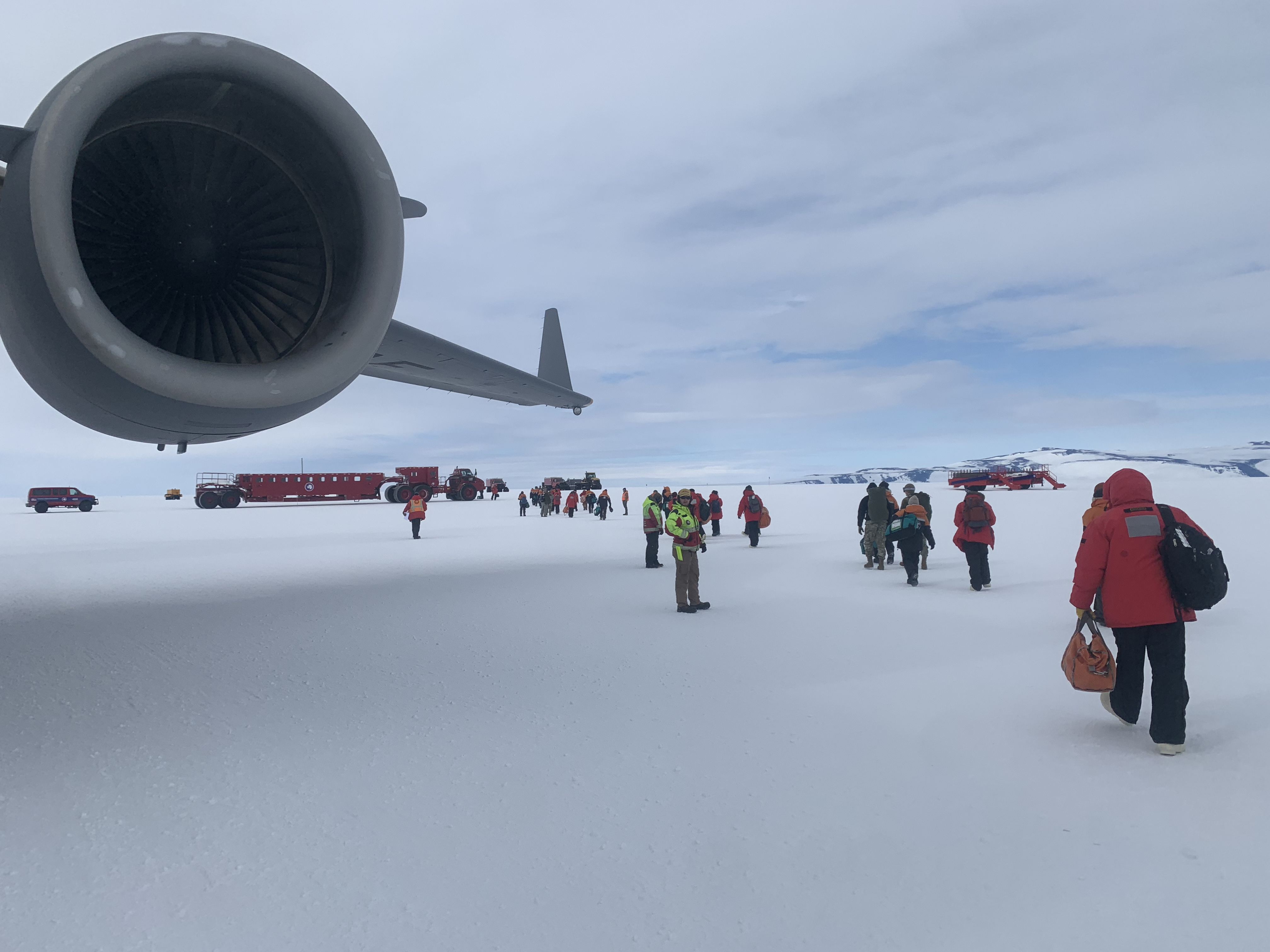
Scientist Chester Ruszczyk and engineer Parker Steen recently flew to Antarctica via Christchurch, New Zealand, where visitors receive intensive training on conditions and safety procedures for the unique challenges faced by visitors to the southernmost continent. Ruszczyk and Steen traveled there in November and have been setting up and flying on reconnaissance missions to determine the best location for the three highly sophisticated ice penetrator systems.
Working with personnel from the National Science Foundation’s Office of Polar Programs (OPP), the team is completing the build and readying the ice penetrators to be dropped from a sling underneath a helicopter flying at a moderately high (about 5,000 feet) altitude; such a deployment would be a daunting task anywhere, but is especially challenging amidst Antarctic storms, so scheduling takes some time to finalize, along with procedures carefully designed to minimize risks.

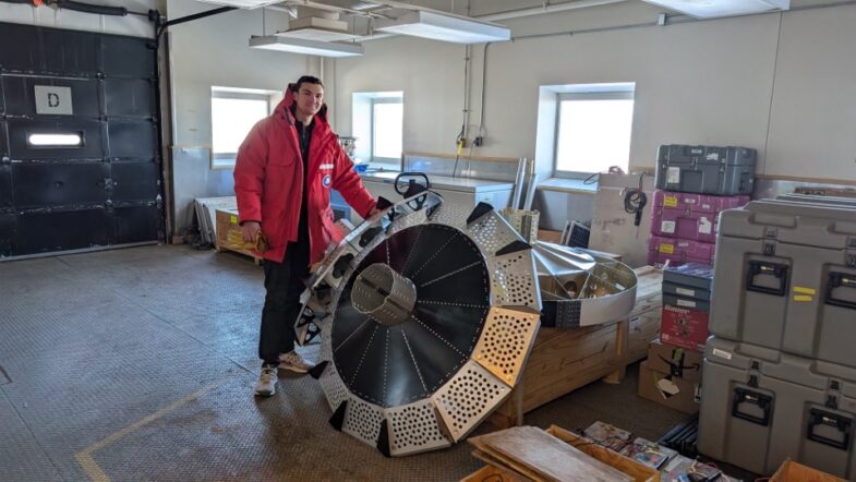
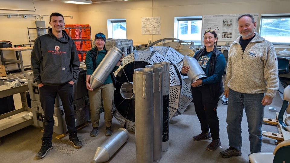
To monitor the vital yet endangered Ross Ice Shelf, the ice penetrators contain extremely sensitive broadband seismic devices and geodetic-quality Global Navigation Satellite System (GNSS) receivers designed to monitor and transmit information on ice behavior, such as flexing, vibrating, drifting, rifting, and cracking and other motions at the marine front of the ice shelf, less than 5 km where calving occurs – that is, where huge pieces of ice break off becoming tabular icebergs.
Because of the high-risk environment, the team undertakes reconnaissance missions with a pilot and mountaineer expert to check for presence of dangerous crevasses, measure polar winds, and look for safe, level surfaces. Two ice penetrators will be dropped and a third will be installed manually. Ice samples or “cores” 2–3 m long and around a foot in diameter are being drilled in the area to allow for examination of density profile and stratigraphy—that is, the type and structure of the ice at the final locations.
Once dropped and implanted, the SGIP devices will stream back science and engineering data to the Haystack basecamp team in real time via an Iridium satellite constellation. The SGIP devices are powered by large lithium battery packs, also a unique feature designed and built by Haystack engineers. As explained on the project site, “Two helicopters will be used for deployment of each SGIP, one with a long line and remote hook to drop the instrument and one carrying participants to evaluate, guide and confirm the drop.”
Lead scientist Pedro Elosegui expressed cautious optimism about the project. “SGIP opens up the possibility of in situ probing of the cryosphere at high-risk polar environments such as the critical calving front of ice shelves,” he said, “but is still a very high-risk project.”
The SGIP devices will remain in place over the winter and will be retrieved in the following year by another team deployed from Haystack.