Antarctica and seismo-geodesy: successful SGIP demonstration
The MIT Haystack Observatory polar geodesy team of scientists and engineers, in collaboration with MIT AeroAstro, has successfully designed, built, deployed, operated, and retrieved unique seismo-geodetic ice penetrator (SGIP) instruments in Antarctica. (“Geodetic” refers to the science of geodesy, the measurement of the earth, including its cryosphere or frozen water.)
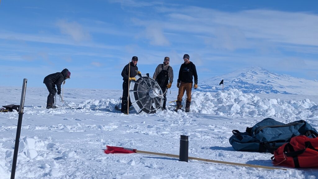
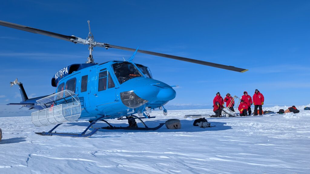
Originally deployed in 2024 on Antarctica’s Ross Ice Shelf (RIS), the SGIP (pronounced ess-jip) instruments were air-dropped, embedded in the ice, and operated continuously enduring the rigors of Antarctic harsh climate while monitoring ice movement and conditions. In December 2025, the three instruments were dug out of the ice shelf by teams from McMurdo Station, led by Haystack’s Chester Ruszczyk.
We have been dreaming about a better understanding about what’s happening in Antarctica in real time, and now we have the technology to do it.
–Pedro Elosegui

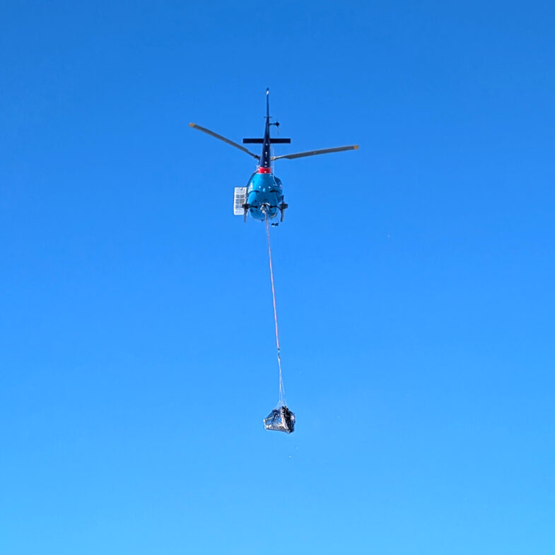
Devised to measure ice behavior such as quaking, vibrating, flexing, and drifting on the marine front of the RIS, each of the SGIP devices was dropped from a helicopter from about 1.5 km (5000 feet) to embed itself 3 to 4 meters deep in the RIS. Data obtained by on-board sensors was successfully transmitted in real time to Haystack computers via Iridium communication satellites for scientists to monitor and analyze.
“This is the first time that highly sensitive and extremely delicate sensors, particularly a broadband seismometer, have been dropped out of a helicopter. Understandably, the project had been viewed as high risk. But we have surpassed even the most optimistic expectations, turning it into a high-reward project,” said Pedro Elosegui, head of the Haystack geodesy department. “We have been dreaming about a better understanding about what’s happening in Antarctica in real time, and now we have the technology to do it. The approach is also adaptable to learn about other critical elements of the cryosphere, such as how icebergs decay and freshen the ocean, and their impact on the global ocean circulation and the climate. This is observational science fiction made reality.”
The SGIP device is designed to obtain science-grade, glaciology-critical data in remote, dangerous locations in a way that minimizes risk to humans—with future deployments, the helicopter drop method will keep scientists out of harm’s way by avoiding increasingly hazardous conditions on ice shelves that are “calving” or breaking apart due to climate change.
The devices cannot be left in place indefinitely, as Antarctic field equipment protocols require removal from the ice.
“Preliminary analysis of geodetic data shows in detail how the ice on the shelf is flowing towards the ocean at a rate of 2 to 3 meters per day while bobbing with the ups and downs of the daily ocean tide,” said Dhiman Mondal, Haystack geodesist and SGIP project scientist. “The seismic data are richly imprinted with the response of the ice shelf to all kinds of geophysical signals, such as earthquakes, icequakes, ocean swell, and infragravity (i.e., low-frequency ocean) waves.”
Data is currently in the analysis stage with Haystack scientists and results will be published later this year.