Anthea Jane Coster
Assistant Director; Principal Research Scientist Physics of the ionosphere, magnetosphere, and thermosphere. Space weather. Global Navigation Satellite System positioning and measurement accuracy. Radio wave propagation.I finished my PhD at Rice University in 1983 while working at the Arecibo Observatory in Puerto Rico. After leaving Rice, I moved to MIT Lincoln Laboratory, where I was the atmospheric scientist on staff for the Millstone Hill satellite tracking group for many years. I have been working with GPS since 1985, and was lucky to be involved with many of the early ionospheric discoveries utilizing GPS to monitor the ionospheric total electron content. In 1991, together with coworkers at MIT Lincoln Laboratory, I developed the first real-time ionospheric monitoring system based on GPS.
More recently, I demonstrated the existence of mid-latitude storm enhanced density plumes using GPS data. I have also been involved with measuring atmospheric disturbances over short baselines (GPS networks smaller than 100 km) for the U.S. Federal Aviation Administration, and have coordinated meteor research using the ALTAIR dual-frequency radar for NASA. Since joining MIT Haystack in the early 2000’s, one of my main responsibilities has been to develop the GNSS total electron content database in Madrigal for the CEDAR community. This database has been used to provide material for the publication of 200+ scientific articles, for two news conferences on space weather effects, NASA and NOAA (2005), and several highlights. We have recently included GLONASS data and added a new line of sight GNSS TEC product for the community.·
I am one of the current co-chairs of the NASA Living With a Star Program Analysis Group (LPAG) (2018-current) and I recently served as a member of the National Academy Committee for the Review of Progress Toward Implementing the Decadal Survey – Solar and Space Physics: A Science for a Technological Society (2019). For the past 10 plus years, I have taught in the yearly NSF-sponsored incoherent radar summer school (2008-2019), as well as teaching in GNSS courses designed for students from underdeveloped countries. I have been actively involved with broadening the participation of groups underrepresented in science, mathematics, engineering and technology by mentoring several undergraduate students through the Research Experience for Undergraduate (REU) program, including three female REU students, and served on the PhD committees of two female graduate students (2004, 2009).

Using GNSS to Measure Ionospheric TEC
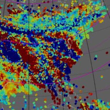
GNSS systems for precision location yield as a by-product measurements of the total electron content (TEC) of the ionosphere. MIT makes this popular data available to the geospace community.

MACAWS: Monitors for Alaskan and Canadian Auroral Weather in Space
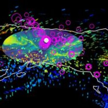
A sensor web network providing both real-time and historical GNSS TEC and scintillation data products.